Supplier Group Monitoring Program
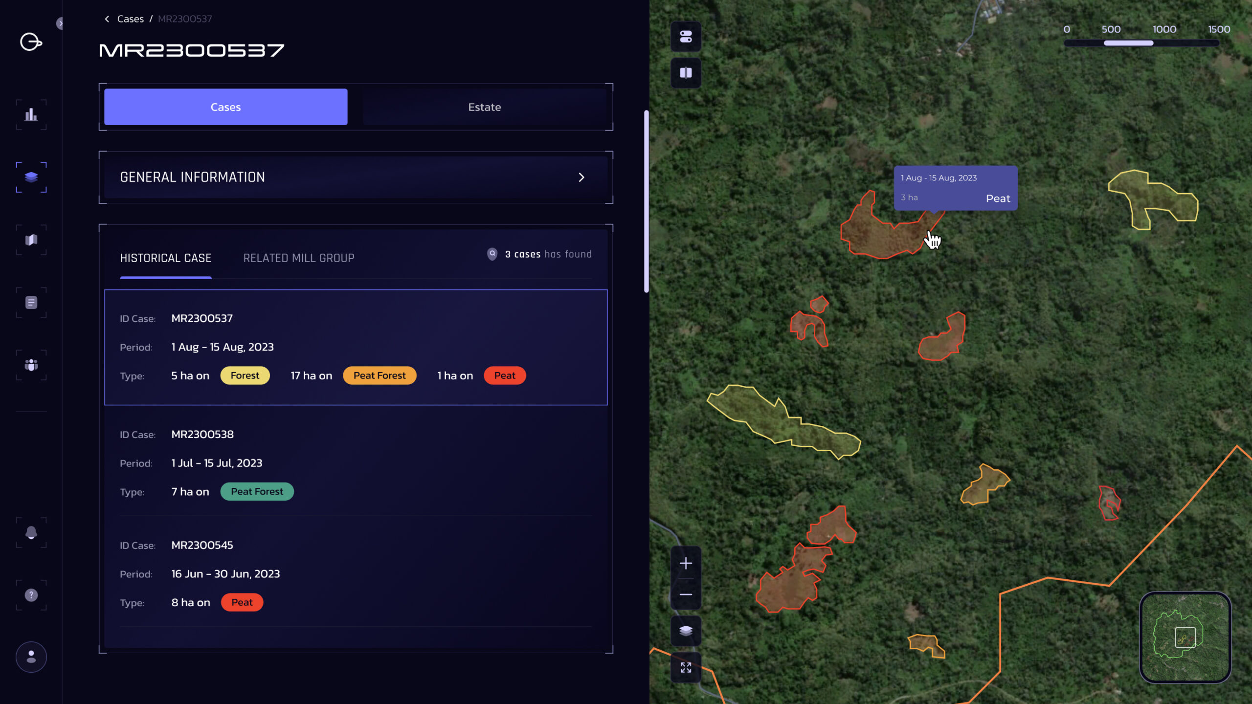
Deforestation can proceed greatly within a short timeframe, and once detected, it can quickly escalate into a major reputation risk. Businesses need up-to-date intelligence on the ground to be able to take prompt action on potential sustainability risks in their supply chains. The SGMP utilizes a robust, data-driven approach to define, assess, and report NDP non-compliance in near-real time, which is further supplemented by grievance engagement updates, supply chain links, and group ownership information.
Since 2014, the SGMP has significantly contributed to the companies’ efforts to address the NDP risks in their oil palm supply base. What distinguishes our method from other similar deforestation monitoring is the depth of our insight into the landbank layers and our capability to establish a supply chain link between a particular farm/plantation where a clearing is detected and other facilities further downstream. This represents a reactive step in addressing sustainability risks in the supply chain.
Group suppliers are categorized based on the following criteria:

The Supplier Group Monitoring Programme has evolved into an interactive dashboard called Geometrack. This tool facilitates the identification and monitoring of deforestation and peatland conversion risk areas within your supply chain.

What Will You Get:

Find the Solutions that fits with you
Inovasi Agriplot

The Most Reliable and Comprehensive Sustainable Supply Chain Traceability System
Read More
Inovasi Agriplot Due Diligence System
Turn-key Solution to Meeting EUDR Due Diligence Requirements
Read More
Extended Helpdesk
Inform Risk-Related Decision Making
Read MoreTraceability
Connecting the Dots and Bridging the Gaps to Understand your Supply Chain
Read More
Corporate Group Profiling
Tracking Corporate and Trade Relationships to Understand Business’ Priorities
Read More
GHG Traceability
Identify and Monitor the GHG Emission under Scope 3 Requirement
Read More
Partnership Program
Empowering Partnerships for Sustainable, Compliant Palm Oil
Read More